1 / 17
German WH /Allied RoadMap Newcastle /Frankfurt
Available
€85.00
—
Description
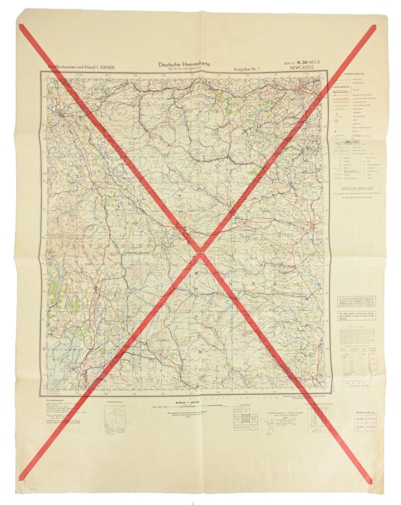
In a very good condition a stunning item.The map is made by the German Wehrmacht in 1942 by the 'Generalstab des heeres,Abteilung fur Kriegskarten- und Vermessungswesen'.The mapcard contains the Newcastle England region.The card comes in a scale of 1: 200 000 and has a size of 60x80cm.The mapcard is cancelled and during the war re-used by the British War Office in 1943.The british army printed the reverse side of the German map with the region of Frankfurt am Oder.A very stunning multiple used mapcard!
Dealer Info
Dealer Info
-
 Netherlands