1 / 14
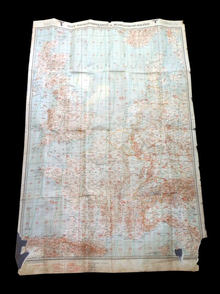
WW2 German Luftwaffe 1:2000000 Fliegerkarte – PILOT MAP – BATTLE OF BRITAIN RARE
Sold
$399.99
—
Description
You are bidding on a VERY NICE used example of a WW2 German Luftwaffe 1939 1:2000000 Fliegerkarte (Pilot Map) as used by both Fighter Pilots and Bomber crews for navigation. This map is titled 'Luft-Navigationskarte in Merkatorprojektion' (Air Navigational Map in Mercator Projection), Zusammendruck West.This map allowed the pilot to properly calculate his flight path. It is made heavy paper.Made of a heavy paper that has been adhered onto a fabric backing, this map is in EXCELLENT condition for its age. It measures a approx. 2 feet x 3.5 feet in size, and covers the United Kingdom, as well as most of Western Europe. 'Zusamendruck West' (Western Summary) is written at the top, and overall it includes all of England and Scotland; as well as parts of Germany, Belgium France, Denmark, Ital, Spain, Switzerland, and Sweden. It features various locations of lakes, seas, towns, villages, cities, and elevations. Also features longitude and latitude degree markings, and Pilot Grid. This one indicates a map date of 1939, but was probably printed around 1941.Though there are a few folds and slight tears, there is NO major damage…and ALL colors are VERY vibrant! It is also named at the top. A VERY RARE and FANTASTIC addition to any collection, display, or simply as a conversation piece!
Dealer Info
Dealer Info
-
 Thousand Oaks, CA · United States