1 / 9
WW2 French Édition Provisoire – 1:40000 TOPOGRAPHICAL MAP – ARDENNES – VERY RARE
Available
$149.99
—
Description
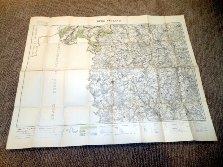
You are bidding on a SUPERB example of a WW2 French Military Édition Provisoire1:40000 scaleTopographical Map! This is a French Provisional Military Map, produced using original German cartography plates, and reissued for post-liberation military use.French 'Édition Provisoire'military maps of this type were produced during and immediately following the liberation period using existing German cartographic source material. Rather than conducting new surveys, French cartographic authorities reused captured German military map plates, issuing these as provisional editions to meet urgent operational needs. These maps were used for navigation, planning, and terrain analysis, particularly in contested and strategically important regions such as the Ardennes, where precise elevation, road, rail, and infrastructure detail was critical.Made of paper, this map is in SUPERB condition for its age! The original cartographic survey dates to the early 1920s, with this map representing a French provisional reissue derived from German military plates, as confirmed by the French legend noting reduction from German cartographic material. The map retains its original black-and-white printing with clear contour lines, infrastructure markings, and terrain detail throughout. Condition is consistent with period military handling and storage and may include fold lines, light staining, edge wear, and minor handling marks. This is NOT a modern reproduction or later reprint. Covering the areas of the Ardennes, itA VERY INTERESTING and HISTORIC example reflecting the transitional reuse of German military mapping by Allied forces during WW2!
Dealer Info
Dealer Info
-
 Thousand Oaks, CA · United States