1 / 8
WW2 British War Office Army – 1:100,000 TOPOGRAPHICAL MAP – BONN – 1944 – NICE!
Available
$199.99
—
Description
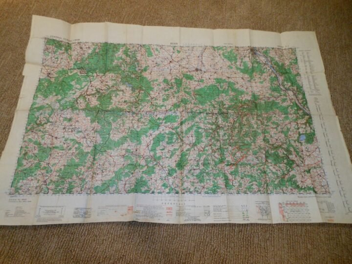
You are bidding on a VERY NICE example of a WW2 British War Office 1:100,000 Topographical Map! Used for operational overview, they offered a balance between regional coverage and tactical detail.This map is titled 'Bonn', and and measures approx. 26″ x 40″ in size!British War Office maps of this type were produced for planning, navigation, and tactical coordination by Allied ground and air forces. Issued under General Staff (G.S.) designation, these maps were commonly used during the buildup and execution of operations in northwest Europe following the 1944 invasion, providing standardized terrain, infrastructure, and elevation data for operational use.Made of heavy paper, this map is in GOOD condition for its age. Dated 1944, it is printed on original wartime paper and remains fully readable and usable, with its original full-color printing intact. Condition is consistent with period military use and storage and may include fold lines, edge wear, minor tears, light staining, and handling marks. Not a modern reproduction or later reprint. The map retains clear color differentiation, legible text, and visible contour and grid details.A VERY RARE and FANTASTIC addition to any collection, display, or simply as a conversation piece!
Dealer Info
Dealer Info
-
 Thousand Oaks, CA · United States